
Life in the Bike Lane
Life in the Bike Lane
Cape Cod Life / June 2026 / Recreation & Activities
Writer: Chris White
Take the scenic route and explore four of the Cape’s most beautiful bike trails, wending your way along coastlines and classic landscapes.
Legend says that when the first Europeans arrived in North America, a squirrel could travel from the Cape to California without ever touching the ground, so forested was the land. For Cape Cod cyclists, a similar (but more localized) possibility is looking more realistic—a network of multi-use bike paths stretching as an unbroken chain from Woods Hole to Provincetown. With about 60 miles of paved trails already, the gaps are narrowing. Aside from a few crossings, a bicyclist can now cover most of the Cape while avoiding the roads. If current plans hold, more routes such as the new 4.1-mile Sandwich Service Road Path will be coming online in the upcoming years. One force that’s keeping the wheels rolling forward has been the Cape Cod Commission and its mission “to protect the unique values and quality of life on Cape Cod by coordinating a balanced relationship between environmental protection and economic progress.”
In 1990, Governor Dukakis signed the organization into law after an act of the Massachusetts legislature, and the Commission has been active ever since. Its website states, “A number of projects are underway to improve access for cyclists and pedestrians.” Many of these fit under the umbrella of Vision 88, which would conjoin the Cape’s major bike arteries and create 88 miles of continuous paths from Woods Hole to Provincetown. Progress is well underway with just ~34 miles left to be built and connected. While other paved paths exist on the Cape, the main four are the Shining Sea Bikeway, from Woods Hole to Cataumet; the Cape Cod Canal Bikeway, from Bourne into Sandwich; the Cape Cod Rail Trail, from South Yarmouth to Wellfleet; and the Province Lands loop in the dunes and forests of Provincetown.
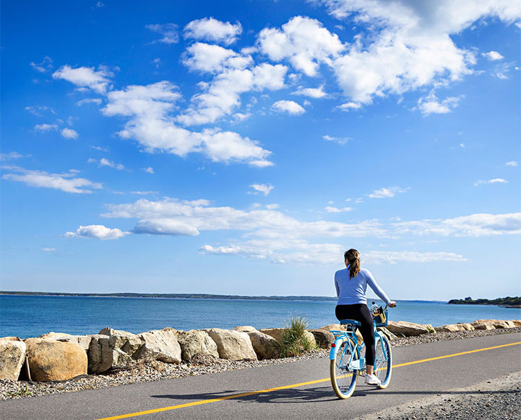
Photo by Randi Baird Photography, Courtesy of the Cape Cod Chamber of Commerce.
Three main gaps currently break the chain of paths, each in a different phase of completion. The first, between the Shining Sea Bikeway and the Canal Path, is about six miles and is partially funded. The second, between the Canal path and the Sandwich Service Road, runs through Sandwich Village and is still in early planning. The third, and largest, is the 16.5-mile stretch between Wellfleet and the Province Lands, which has no funding yet. Following last year’s completion of the Sandwich Service Road section, the Barnstable extension is the most active project within Vision 88. Currently under construction, the 4.4-mile stretch will push the western end of the Cape Cod Rail Trail from West Yarmouth to Mary Dunn Road in Barnstable. New parking lots are slated for locations at Mary Dunn Road and Higgins Crowell Road. In addition, a new bridge that will span Willow Street is in the works for 2026. After that comes Phase 4, a 10-mile extension from Mary Dunn Road to the Barnstable/Sandwich town line. This is currently in the design process, with no construction timeline yet. Once complete, this would join the CCRT with the Service Road path, leaving only Sandwich village as the remaining gap between Wellfleet and Bourne.
Momentum seems to be building, but Vision 88 is doing anything but coast. This summer, the Cape Commission will undertake data collection across existing and planned trail corridors. An interactive map and public comment tool should launch in the fall 2026, followed by a final report in fall 2027 that will outline existing conditions, recent progress, and future opportunities. A dedicated Vision 88 website will serve as the central hub. According to the website, “These efforts will help move Vision 88 from concept to implementation.” Jeff Craddock, owner of Sea Sports Cyclery and Outdoor on Route 132 in Hyannis, is a native Cape Codder and elite-level cyclist who leads rides throughout the year. He says, “A unique aspect of our setup is the diversity of the paths, offering everything from the dunes of Provincetown to the Cape Cod Canal and everything in between. One major advantage is the connectivity they provide; riders can use the paths to link different open road sections, creating scenic, low-traffic, and enjoyable routes.”
From tip to tail, here are some observations about our four main bike paths.
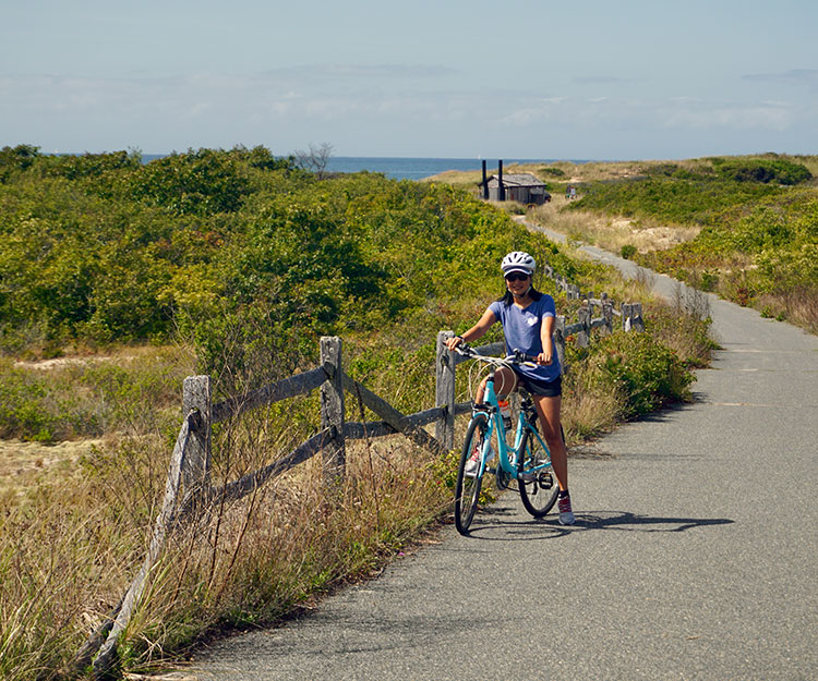
Photo by Chris White
Province Lands
Beauty may be in the eye of the beholder, but the Province Lands loop offers cyclists a window into Cape Cod’s most stunning landscape. And unlike most of the beaches up here, parking is free at the Province Lands Visitor Center, 171 Race Point Road, just before the airport. From here, you should ride down by the amphitheater, turn right, and proceed in a clockwise direction. The path winds around the buildings, above the dunes, then drops into a fun, curving descent into the beech forest. As you spin past Blackwater Pond, you’ll find a short spur that brings you down to Bennett Pond, another little kettle hole. From there, you can head out towards Herring Cove Beach.
The Province Lands Bike Trail is easily the steepest of the Cape’s pathways, and some of the hills offer a good challenge and a reminder that we actually have some elevation change along the spines of the Cape. (The Sandwich Service Road will convey a similar message, as it climbs along the “Cape Cod Alps.”) The full loop, including the spurs to Herring Cove and Race Point Beach, runs for about 10 miles—and nearly 600 vertical feet. Along the route, you’ll experience a few distinct ecosystems, as well, from the beech forest and ponds to cranberry bogs to the dunes. And of the local bikeways, Province Lands tends to be the least busy.
Cape Cod Rail Trail
Moving south (or, ironically, “up”), the next major pathway is the Cape Cod Rail Trail. The Cape Cod Central Railroad was completed 1865, and passenger service ran through 1937. The trail opened 1978 and has since become part of the East Coast Greenway, a 3,000-mile “corridor” of interrupted sections from Florida to Maine.
The CCRT gets a lot of mixed bike traffic, including heavy commuter use. Much of it feels suburban, but you’ll also pass scenic areas, and at Mile 14, you’ll find Nickerson State Park, with an additional 8 miles of forested trail. Probably the “best” and most heavily traveled section runs from Harwich to Orleans, where you’ll find easy access to restaurants, ice cream shops, and the inimitable Hot Chocolate Sparrow. The Salt Pond Visitor Center at Nauset and the National Seashore offer the only real hills on the 25+ mile path, but overall, this out-and-back is long enough for good training rides, especially if you pick less popular times of day. As construction continues from Yarmouth into Barnstable, Craddock says, “I am particularly excited to see the ongoing expansion of the Cape Cod Rail Trail.” This will be huge, actually, because it will allow cyclists to ride from Hyannis all the way to Wellfleet.
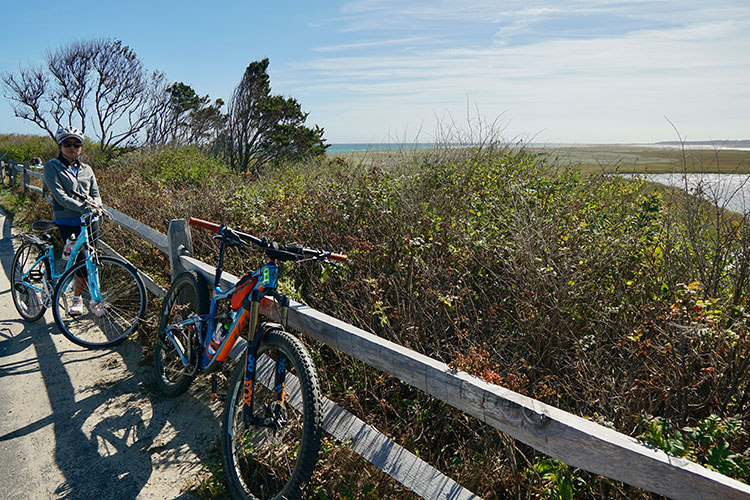
Photo by Chris White
Cape Cod Canal Bikeway
The Canal is another out-and-back, and there are a couple of ways of approaching it. On the western shore side, you can park at the railroad bridge in Buzzards Bay and ride up to Scussett beach. This side tends to have the most fishermen, so it can be fun to watch people pull in stripers. The only real downside of riding the canal in this direction is that you’ll be fighting the prevailing southwest breeze on the way back. If you don’t have an e-bike, you’ll definitely feel the increased resistance against a 15-knot headwind.
Probably the best way to hit the canal is from the eastern shore. Park at the Sandwich Marina Park and ride south. When you return, you’ll likely have the wind at your back. The parking lot is right next to a few restaurants, too, such as the Pilot House, the Fisherman’s View, and Shipwreck Ice Cream. Buzzards Bay also has good eating options including Krua Thai, on Main Street, just across the street from the parking lot. The only end of the canal trail with no food is the one at the southeast corner, in Bourne. This is also the quietest parking area, though, and it’s a nice spot for a picnic. If you are comfortable on roads, you can extend your ride by pedaling through the village and up across Route 6. As Craddock says, “The new path in Sandwich along the service road is amazing as well.” For gravel cyclists, this is also a nice spot to head into the woods and ride the dirt fire roads within the Maple Swamp conservation area.
Shining Sea Bikeway
If the Shining Sea’s name rings bells, it might be that you’re hearing echoes of “America the Beautiful,” the composer of which was Falmouth native Katharine Lee Bates. Another rails-to-trails project, the Shining Sea is best experienced from the north. The main parking lot sits near the corner of Route 151 and Old Main Road, and one of Bike Zone’s four locations is right there if you need to rent a bike or pick up a spare tube, a new water bottle, or some local cycling knowledge. Heading south, you’ll pass through cranberry bogs, a farm, and conservation land, including Great Sippewissett Marsh around Mile 4 and Little Sippewissett Marsh about a mile later. Keep your eyes out for birds and turtles! On a sunny day, this 190-acre estuary is especially pretty with its vibrant greens extending out to the bay.
At about the 7 mile mark, you’ll hit Falmouth Village, where a short detour will take you to Corner Cycle, another of the Cape’s longtime hubs for the biking community. Across the street, you can grab a shot of espresso and some fuel from Coffee Obsession. The next stretch carries you past Salt Pond and Oyster Pond before spilling out to the beach. You’ll follow along the shoreline of Vineyard Sound with some of the nicest views on the Cape. The final stretch brings you into Woods Hole, at the back parking lot for the ferries. Grab a mudslide at The Landing or a pastry at Pie in the Sky. Or, if you’re looking to extend the ride, hop on the Steamship Authority and head over to Martha’s Vineyard, where you’ll find even more bike paths.
Wherever you cruise along the Cape’s awesome network of bikeways, it’s easy to get lost in the scenery and to sense the community that revolves (ha ha) around cycling here. But it’s also good to keep in mind that we’re pulling closer to realizing the dream of Vision 88, as the chain continues to add links. Craddock says, “My hope is to eventually see a continuous path connecting Woods Hole to Provincetown. It would be a worthwhile project that benefits our local community and tourism alike. The Cape’s bike path infrastructure is amazing and continues to improve. It is a true destination that has provided adventure for families for generations.”
Chris White is a freelance writer for Cape Cod Life Publications.

